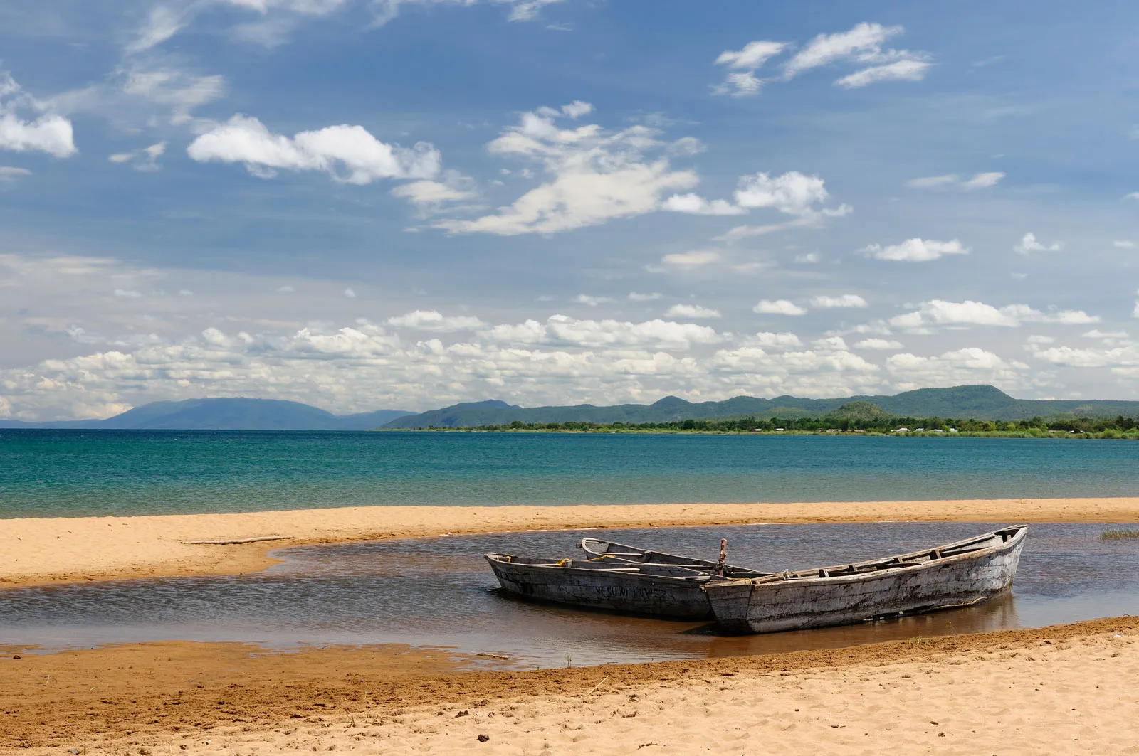
Republic of Burundi
Often called “The Heart of Africa” and covers an area of 27,834km2. Burundi is landlocked and borders with Rwanda, Tanzania and Democratic Republic of Congo, thus forming part of the Central African Region.
Various studies have been conducted since 1959 for petroleum exploration both on the Rusizi Basin and in the Lake Tanganyika Basin. These basins are part of the East African Rift System and are located between Burundi, the Democratic Republic of the Congo, Tanzania and Zambia.
This Rift System is dated from Cenozoic (Tertiary) and is divided into two branches: the eastern arm and the western arm. Lake Tanganyika and the Plain of Rusizi belong to the western branch, which consists of sedimentary basins marked by deep Lakes (Malawi, Tanganyika).
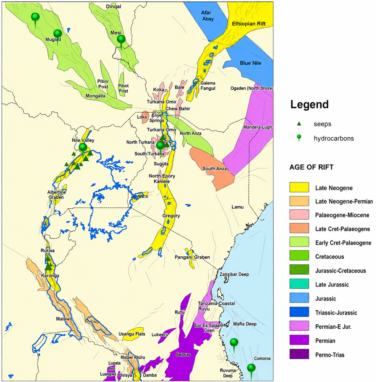
In Burundi, these basins cover an area of 2,968.1km2. Geological studies, gravimetric, aeromagnetic and seismic surveys have been conducted in the two basins, and the average sediment thickness is estimated at more than 3,000 meters.
HISTORY OF OIL EXPLORATION IN BURUNDI
Various studies have been conducted for petroleum exploration both on the Rusizi Basin and in the Lake Tanganyika Basin.
- 1946-1947: First study from the « Mission hydrobiologique au lac Tanganyika, led by E. Leloup,1949.
- 1961: sediment cores obtained by Livingstone (1965) and Degens et al., 1971);
- 1983-1984: ”Probe” academic seismic grid acquired by Duke University
- 1984: Kenting Aeromagnetic survey acquired
- 1984-1985: Project Geo-Rift studied lakebed geology, supported by Elf Aquitaine
- 1986-1987: Amoco acquire seismic onshore and drill 2 shallow dry wells:
- Neogene section all sandstone, failed due to lack of seal
- Expect rapid geological changes into lake to south with incoming of seals and source rock - 2008-2017: Blocks A-D awarded to Surestream, Minergy, ABC Petroleum and A-Z Petroleum Products for petroleum exploration.
LAKE TANGANYIKA TECTONIC ELEMENTS
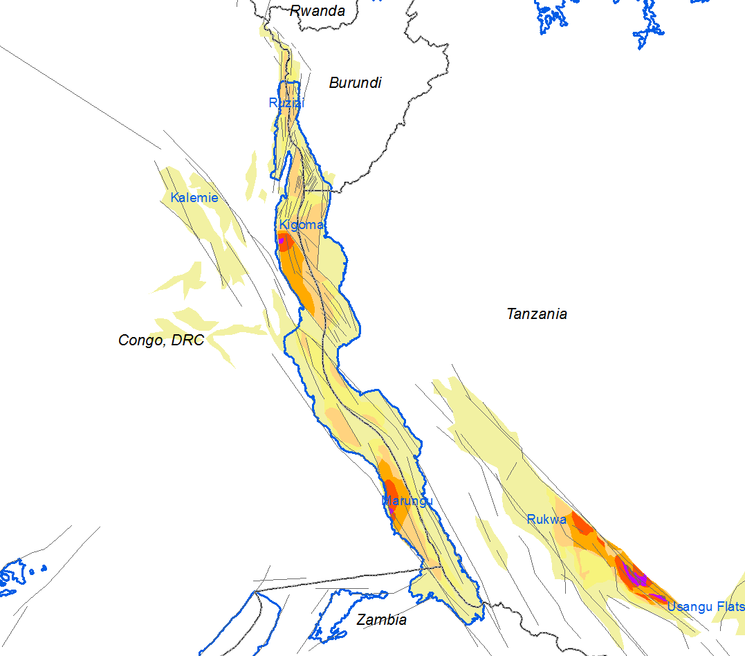
Lake Tanganyika comprises several sedimentary basins separated by basement highs. The northern basins are predominantly of Neogene age, while the southern basins contain sequences that date back, in part, to the Permian period. Burundi's territorial waters encompass two of these basins, making them significant for understanding the lake's geological evolution and resource potential.
Burundi's territorial waters encompass two of these basins: the Ruzizi Basin, which is poorly constrained by seismic data but is estimated from aeromagnetic surveys to contain up to 4 km of sedimentary section, and the Kigoma Basin, which is well defined by seismic data and contains up to 5 km of sedimentary section in the adjacent Congolese waters.
Northern Lake Tanganyika Tectonic Elements
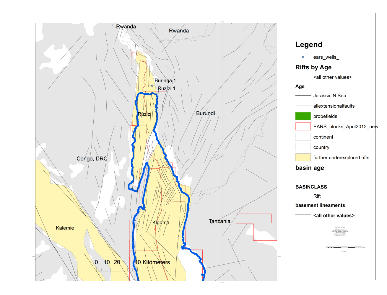
- Ruzizi and Kigoma Basins are separated by Ubwari Basement High.
- Faulting within each basin follows ancient Basement lineaments – Ubendian and Kibaran trends.
- High trapping potential at intersections of these trends
Northern Lake Tanganyika Seismic
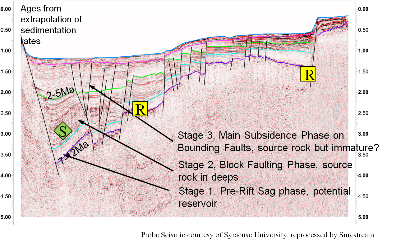
- Section in onshore wells and absence of unconformities suggests section is entirely Neogene in age.
- Three stage evolution of basin apparent from seismic analysis.
West-East Play Cross-section
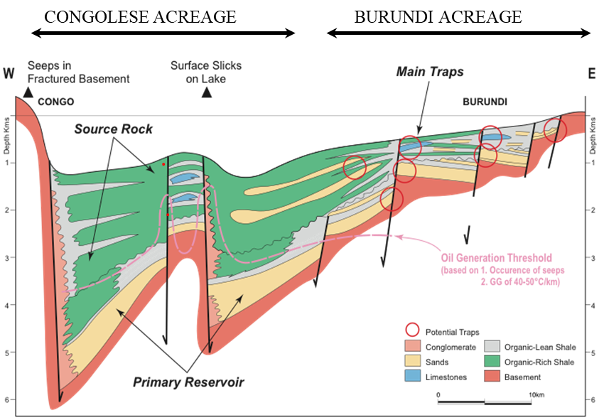
- Section across Kigoma Basin from deep in Congolese waters to southernmost Burundi block.
- Primary target believed to be basal sandstones developing in lowest seismic sequence.
- Charged from source rocks developed in deepest part of subsiding rift in second seismic sequence, mature in Congolese waters.
South-North Play Cross-section
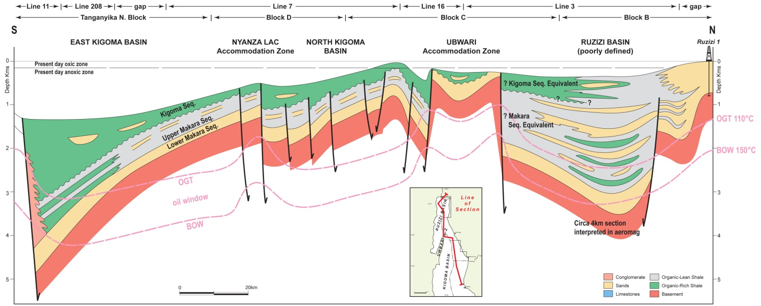
- Section through all Burundi blocks and basins from south to north.
- Ubwari High separates Kigoma and Ruzizi Basins.
- Play types in Ruzizi Basin likely controlled by sand input from palaeo-Ruzizi River: expect rapid facies changes and incoming of source rocks and seals south of Ruzizi 1 onshore well (illustrated).
Possible Oil Kitchens
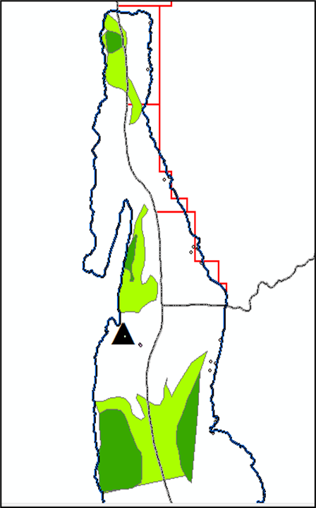
- Other East African Rift Basins indicate that a sediment thickness of circa 2500m is required for oil generation.
- However, high geothermal gradients in Burundi onshore wells (>60 deg C/km) suggest maturity may be attained at around 1500m.
- Deep kitchens identified that should charge Burundian acreage within deepest parts of basins in Congolese sector.
PETROLEUM EXPLORATION BLOCKS
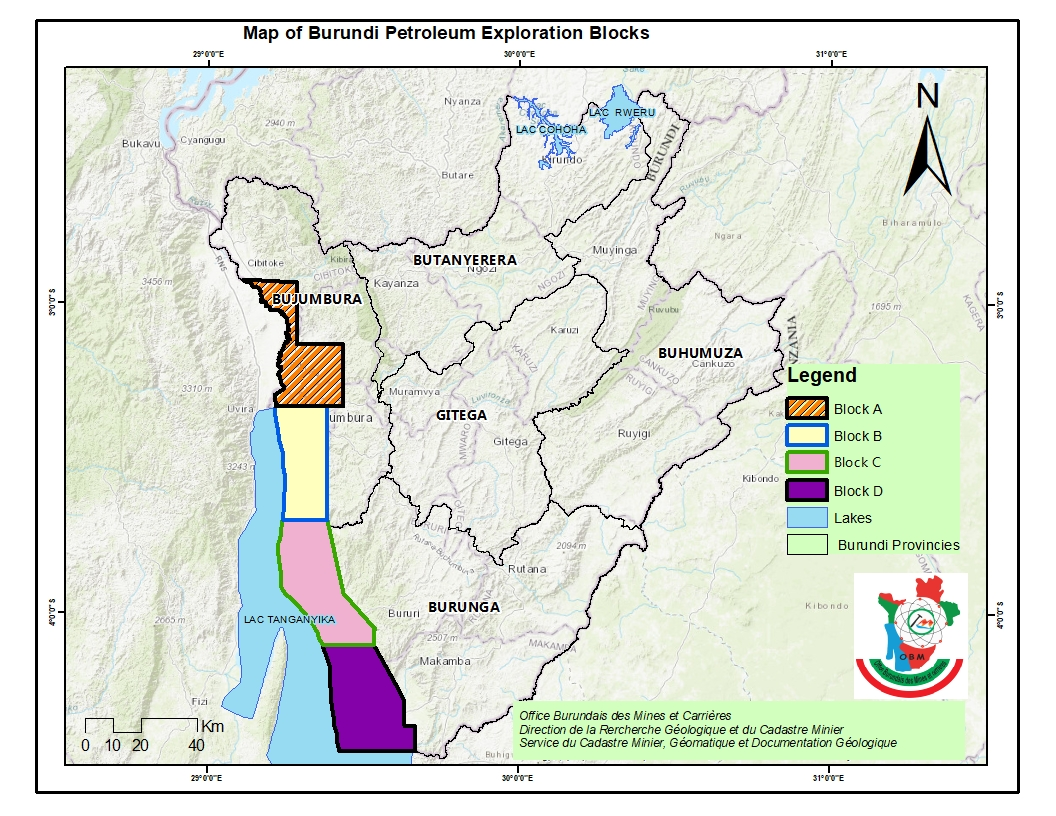
- The exploration areas of Rusizi and Lake Tanganyika basins have been divided into four blocks: A (793.1km2), B (697.1km2), C (664 km2) and D (813.4 km2).
- Block A is on Rusizi Basin which is onshore while blocks B, C and D are offshore in Lake Tanganyika basin from North to South respectively.
Future Activities in Burundi
Planning high quality seismic offshore using converted Tanganyika Explorer vessel from Bujumbura.